AnyRoute

Next-generation routing a analytics
pro public transport a MaaS

AnyRoute considers all mobility services on offer and tailors route recommendations to each particular user a the situation at hand.

Any-Mode

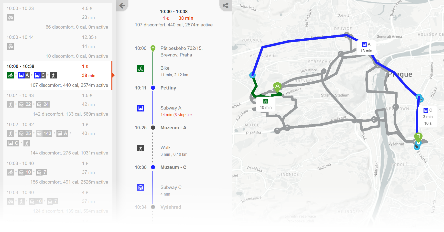
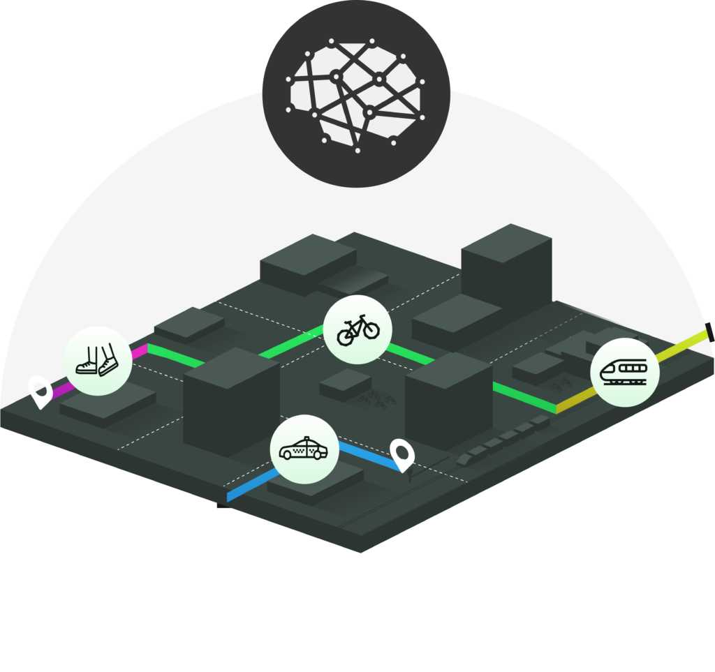
AnyRoute calculates best routes using just any mode of transport–public, private, shared or on-demand–and any mode combination. Park & Ride, Bike on Public Transport, or Public Transport+Ride Hail and beyond–if the intermodal combination makes sense, we will find it!

Situation-Aware

AnyRoute recommends trips that reflect the current situation in the transport system. Public transport delays a cancellations, bike share availability, ride-hail prices or even the weather are just some of the situational factors that are considered in route optimization.

User-Centric

AnyRoute optimizes routes for all the criteria that users care about. Optimize trips for criteria beyond distance and time–price, comfort, fitness a emissions are supported out of the box and others can be added. Personalize route recommendations based on a user's profile and past behaviour.

See AnyRoute in action!

Powered by Deep Tech

AnyRoute is based on the latest research in AI-based multicriteria routing algorithms.

Scalable

Capable of handling national-scale transport networks with unlimited number of transport modes.

Adaptive

Capable of learning from user past trips and interactions with the route planner.

Highly Configurable

Providing unprecedented flexibility in defining hard- and soft- trip planning constraints and optimization criteria.

AnyRoute Analytics

Get data-driven insights into the design, operation a usage of your MaaS or public transport system.

Service Ridership Analysis

Z transakčních dat o nákupu jízden.a jednotlivých linkách a jejich úsecích.XXXXXXXXX XXXXXXXX XXXXXXXX

Public Transport QoS

Calculating public transport quality of service (QoS) coverage KPIs and benchmarking against private car.

Public P+R potential analysis​

Quantifying benefits of intermodal combination of public transport with P+R. XXXXXXXXX

Flexible Integration Options

AnyRoute can easily be integrated into your products and services

{

API

The easiest a fastest to integrate intermodal routing into your mobility products and services.  We take care of all hosting and maintenance–all you need to do is to integrate our AnyRoute API into your system.

- - - - - - - - - - - - - - -

Host your own

For those requiring more control a customization. License our backend trip planning modules and deploy them into your own server stack. Source code licensing also available for those looking for total customizability a independence.

Why AnyRoute?

AnyRoute will give you the agility to launch and evolve innovative mobility services and stay ahead of the competition.

Total Customizability

AnyRoute is super-capable out of the box–but novel use cases always keep coming. We know every corner of our engine and can thus adapt it to just any business use case you imagine!

Experts on Board

You're not only getting a piece of software but a team of AI-educated experts who know routing inside-out. Our experts will be there to resolve any issues and help you fine-tune routing results to perfection.

Future-Proof

From its inception, AnyRoute has been designed with Mobility-as-a-Service in mind. Lean a free of legacy baggage, our engine is ready to handle future challenging use cases for trip planning apps and service.

Example Deployment

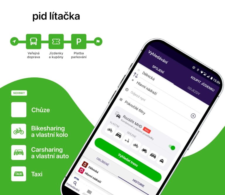
AnyRoute powers PID Lítačka, a next-generation mobility app of the Prague Integrated Transport system (PID). PID is the largest integrated transport system in Czechia, serving more than 3 million people in nearly 1300 settlements in the Prague metropolitan area and beyond. The AnyRoute  provides real-time door-to-door planning integrating all modes of transport available in area, including all their intermodal combinations. The AnyRoute deployment for PID Lítačka is likely currently the most comprehensive intermodal route planner in the world. 

Sounds interesting?

cs_CZČeština
en_USEnglish cs_CZČeština

Analysing Public Transport Ridership

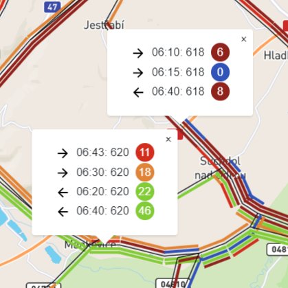
For  a public transport authority (PTA) we have calculated ridership statistics from hundreds of GBs of ticket purchase data. Our analysis provided the PTA with accurate information on how many riders of which category use each public transport service at different times. A challenge here was to reliably map purchase transactions from multiple transport operators to the underlying public transport timetables and to build an interactive map-based data visualization that conveyed the insights the PTA needed to plan optimization of the public transport network.

Key technologies used 

  • GTFS/JDF timetable import and modelling
  • data to timetable matching
  • network-centric data visualization

Public Transport Coverage Analysis

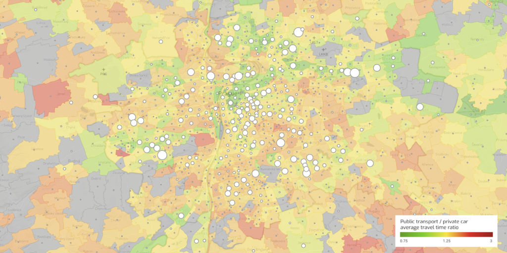
For a public transport authority, we have calculated quality of service coverage metrics and compared them against private car. For each pair of destinations, we have evaluated all available door-to-door public transport connections and evaluated their travel times, frequencies and number of transfers. We have then compared travel times with travel times by individual car to identify origin-destination pairs for which public transport is highly competetive. The analysis served the PTA for optimizing the design of the public transport network.

Key technologies used 

  • GTFS/JDF Timetable import and transport network modelling
  • Door-to-door public transport journey planning
  • Car route planning with real-world travel time data
  • Map-centric interactive data visualization

P+R Potential Analysis

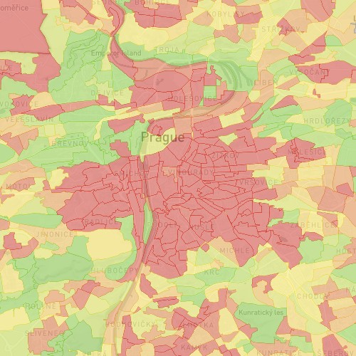
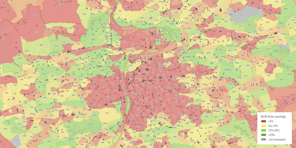
Employing our network-centric analytics tools, we have evaluated the potential for P+R for Prague metropolitan area. For each settlement, we have compared average travel time to the city center between a door-to-door trip with public transport with an intermodal door-to-door trip combining driving to a P+R facility and then taking a public transport from there. The regions with the highest relative travel time savings when employing P+R compared to public transport-only journey are marked as green. The analysis helps to quantify the benefits of building a P+R facilities in different locations around/in Prague.


Key technologies used 

  • GTFS/JDF timetable import and transport network modelling
  • Intermodal door-to-door public transport with P+R routing
  • Car routing with real-world travel time data
  • Map-centric interactive data visualization